Deswik.GeoTools is a set of tools for geological mapping, sampling and drillhole optimization, which integrates seamlessly with the Deswik Suite. Designed to improve efficiency by eliminating the double handing of data, and automating the process of planning infill drillholes. Users can bring their designs, photography, and sample data into their 3D mine design environment. All the data is gathered and captured in the same format enabling teams to work from a consistent platform.
Deswik.Mapping improves the consistency of geological mapping by enabling geologists to use standardized methods, styles and formats when recording their observations ensuring that all data is captured to an agreed standard.
Avoid time spent recreating geological maps in software after the mapping has occurred. Using Deswik.Mapping eliminates the double handling of data involved when transferring paper-based drawings and notes to a software program back at the surface.
Mapping jobs are 100% compatible with Deswik.CAD and are easily imported. Geologists can import the geological maps into master Deswik.CAD documents, with just a few simple clicks as well as retrieve analysis data from external data sources.
Results from Deswik.DHO can be visualized with interactive tabular and graphical reports within Deswik.CAD that can be exported to Microsoft Excel for wider sharing.
Deswik.Mapping incorporates a template which can be configured to ensure a consistent mapping style and standardized nomenclature are employed to record observations. Custom symbols, colours, sizes and names can be used and parameters set to ensure all required data is recorded, for every aspect of the section of an area being mapped.
Use existing models and data within Deswik.DHO to customize the optimization to your requirements.
Easy-to-use, practical tools requiring no expert knowledge of geological databases.
Bring the assay results into the same 3D integrated environment as other geological and mining data to inform better decisions.
Make informed budgetary and tactical plans from the optimized results generated in Deswik.DHO.
Deswik.Mapping is a Windows tablet app that allows geologists to create geological maps and photography while offline and underground. Users can establish their location in 3D space, using survey markers and tunnel design, before they begin the mapping process. Photographic images can be overlaid with geological mapping, to create a rich representation of the geology being mapped. The geological mapping work can then be imported in Deswik.CAD and made available for other users to view and use within their 3D mine design environment.
Find out more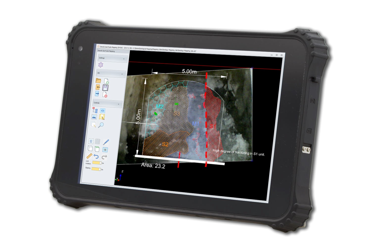
Deswik.Sampling allows underground geologists to manage their face sampling activities directly in their existing 3D mine environment. Users can create and visualize chip and channel sample locations, log geological attributes, and retrieve analysis data from external data sources. Once data is entered, it is immediately available in the Deswik 3D model space and can be viewed and queried alongside other 3D entities such as level surveys, block models, drillholes, and so forth.
Find out more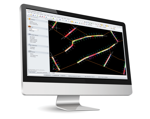
Deswik.DHO uses existing resource model, drilling and classification criteria to maximize the total amount of metal in the model that can have its resource classification upgraded. Users can set up multiple scenarios based on varying drilling budgets, equipment and methods, and assess the cost, as well as the classification uplift of manually planned programs.
Find out more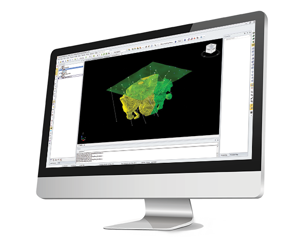
Take a step towards smarter mining. Contact us today to organize a personalized demonstration during which, using your data, we will show you how to optimize your mine performance with Deswik’s integrated solutions.
Request a demo